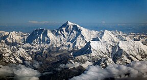
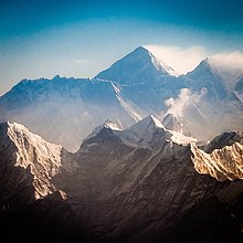
Gunung Everest
Gamal
| Gunung Everest | |
|---|---|
 | |
| Titik ke pemadu tinggi | |
| Peninggi | 8,848.86 m (29,031.7 ka) Ranked 1st |
| Prominence | 8,848.86 m (29,031.7 ka) Ranked 1st (Special definition for Everest) |
| Isolation | n/a |
| Listing | |
| Coordinates | 27°59′18″N 86°55′31″E / 27.98833°N 86.92528°E[1] |
| Naming | |
| Etymology | George Everest |
| Native name |
|
| English translation | Holy Mother, Skyhead |
| Geography | |
Ralat Lua pada baris 524 di Modul:Location_map: Unable to find the specified location map definition: "Module:Location map/data/Nepal" does not exist.
| |
| Location | Solukhumbu District, Koshi Province, Nepal;[2] Tingri County, Xigazê, Tibet Autonomous Region, China[note 2] |
| Countries | China and Nepal |
| Parent range | Mahalangur Himal, Himalayas |
| Climbing | |
| First ascent | 29 May 1953 Edmund Hillary and Tenzing Norgay [note 3] Ranked 1st |
| Normal route | Southeast ridge (Nepal) |


Gunung Everest (dikumbai mega Gunung Sagarmatha tauka Gunung Qomolangma)[note 4] iya nya gunung pemadu tinggi ba Bumi ari tikas tasik, ke bepalan ba sub-rentang Mahalangur Himal Himalaya. Garis entara menua China–Nepal nengah titik puncak iya.[3] Peninggi (seleju) iya 8,848.86 m (29,031 ka 8+1⁄2 in) pemadu baru ditumbuhka dalam taun 2020 ulih piak bekuasa China enggau Nepal.[4][5]
Penerang
[edit | edit bunsu]- ↑ Based on the 2020 surveys of elevation of snow cap, not rock head. For more details, see Surveys.
- ↑ The position of the summit of Everest on the international border is clearly shown on detailed topographic mapping, including official Nepali mapping.
- ↑ It remains unclear whether George Mallory and Andrew Irvine reached the summit in 1924 or not. For more details, see 1924 British Mount Everest expedition.
- ↑ (Templat:Lang-ne; Templat:Lang-bo; Chinese: 珠穆朗玛峰; pinyin: Zhūmùlǎngmǎ Fēng)
- ↑ Templat:Cite peakbagger
- ↑ Geography of Nepal: Physical, Economic, Cultural and Regional by Netra Bahadur Thapa, D. P. Thapa Orient Longmans, 1969.
- ↑ Bishart, Andrew (4 May 2016). "China's New Road May Clear a Path for More Everest Climbers". National Geographic. Archived from the original on 21 September 2018.
- ↑ "Mount Everest is two feet taller, China and Nepal announce". National Geographic. Archived from the original on 8 December 2020. Retrieved 8 December 2020.
- ↑ Joe Phelan (Oct 28, 2022). "Is Mount Everest really the tallest mountain on Earth? It depends how you measure height". livescience.com. Future US, Inc. Retrieved April 27, 2023.
Researchers have measured Mount Everest many times over the past few decades, but the latest assessment, announced in November 2021, puts it at 29,031.69 feet (8,848.86 meters), which is almost 5.5 miles (8.8 kilometers) tall.
